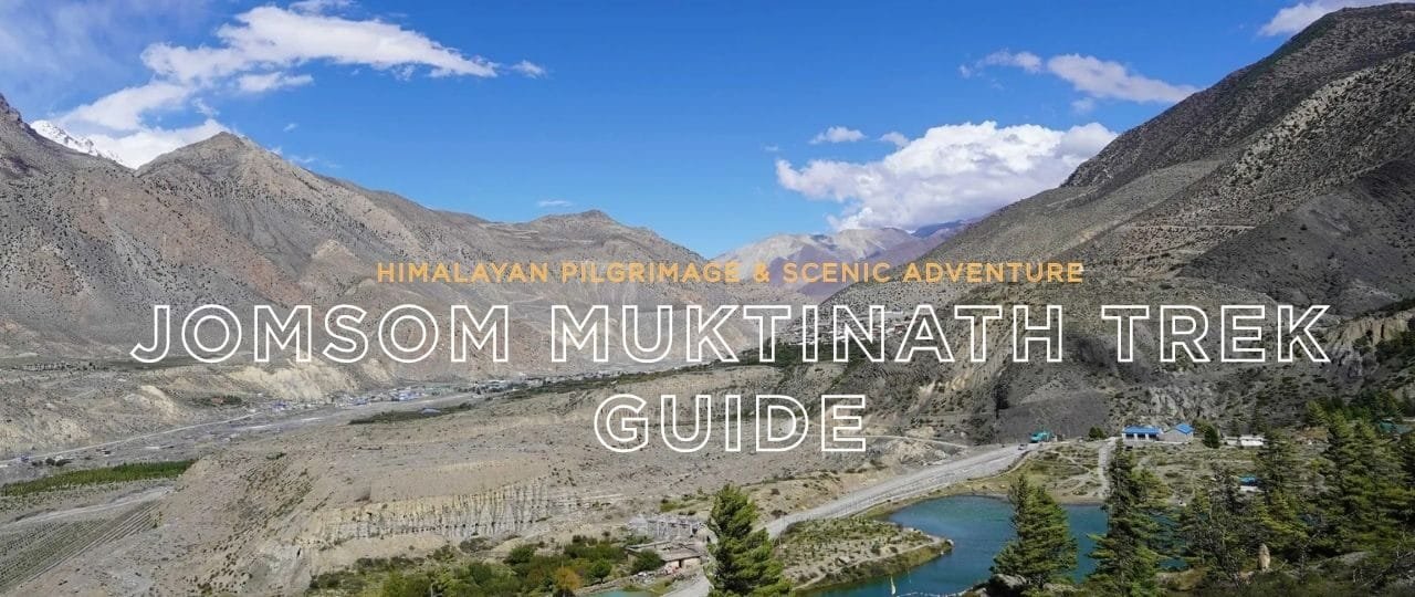
The Jomsom Muktinath Trek stands out for its harmonious blend of religious significance, cultural immersion, and mesmerizing Himalayan backdrops. This trek brings you through the Kali Gandaki Valley—the deepest gorge on Earth—eventually leading to Muktinath, a sacred site revered by Hindus and Buddhists. Over the years, the Jomsom Muktinath Trek Itinerary has evolved from a remote trail to a relatively accessible route, thanks to improved roads and a short flight option to Jomsom. Yet it continues to offer a sense of rugged adventure, with landscapes shifting from verdant farmland to arid plateaus reminiscent of Tibet.
This extensive Jomsom Muktinath Trek guide dissects all aspects of the trek, from the typical Jomsom Muktinath Trek Cost to route specifics, recommended seasons, altitude concerns, lodging, required permits, and more. Whether you’re a devotee seeking Muktinath’s blessings or a nature lover craving a moderate trek in the Annapurna region, you’ll uncover everything needed for this memorable journey. Plus, we’ll explore how Volunteers Initiative Nepal (ViN) can help you merge your trek with meaningful community engagement. Let’s delve into the wonders of the Jomsom Muktinath Trek.
1. Introduction: Why the Jomsom Muktinath Trek?
The Jomsom Muktinath Trek offers something for everyone: spiritual pilgrims, mountain enthusiasts, cultural explorers, and novices wanting a moderate trek. Muktinath Temple, situated at around 3,800 meters, is considered a place of liberation and spiritual cleansing. Meanwhile, Jomsom (2,720m) serves as the region’s administrative center and a gateway to Upper Mustang.
Statistic: According to the Annapurna Conservation Area Project (ACAP), tens of thousands of trekkers visit the broader Annapurna region annually, with a notable portion choosing the Jomsom–Muktinath corridor. Some opt for the route because of religious motivations, while others crave the scenic vistas of Dhaulagiri, Nilgiri, and Annapurna. Despite roads creeping into specific sections, the trek remains popular for scenic hikes, mountain flight experiences, and the chance to see how Mustang’s semi-arid geography meets lush farmland near Tatopani and Ghasa.
“I was drawn to the Jomsom Muktinath Trek not just for the trekking but for Muktinath’s spiritual aura. The desert-like scenery around Kagbeni contrasted sharply with the green lower valleys—I loved that variety,” says Elaine, a 30-year-old trekker from Ireland who completed the trek last spring.
2. Historical & Cultural Overview
Historically known as Dzong-Sampa, Jomsom was once a key trading post linking the Tibetan Plateau with central Nepal. Caravans carried salt, wool, and grains along the Kali Gandaki corridor, fostering a cultural mosaic in architecture and daily life. Conversely, Muktinath is recognized as “Mukti Kshetra” (the place of liberation) within Hindu tradition. Meanwhile, Buddhists revere it for 108 water spouts and an eternal flame believed to represent the synergy of earth, water, and fire elements.
Over time, improved roads and the development of the local airport in Jomsom have made travel more convenient. Yet the route remains steeped in intangible heritage: centuries-old monasteries, prayer flags fluttering in wind-blown valleys, and the multi-ethnic communities—Thakali, Gurung, Magar, and Tibetan–influenced peoples—who still uphold unique traditions.
Trek Itinerary
3. Key Highlights of Jomsom Muktinath Trek Itinerary
A typical Jomsom Muktinath Trek Itinerary can be 7–10 days, though some shorter variations exist if you incorporate a flight to Jomsom. Below is a sample path:
- Day 1: Pokhara → Nayapul → Tikhedhunga (~1,540m)
A ~1.5-hour drive from Pokhara to Nayapul. Start trekking along farmland and cross small suspension bridges before staying at Tikhedhunga. - Day 2: Tikhedhunga → Ghorepani (~2,860m)
A steep climb of ~3,000 steps leads to Ulleri. Trails ascend through rhododendron forests until Ghorepani, famed for sunrise vantage at Poon Hill. - Day 3: Ghorepani → Tatopani (~1,190m)
Descend via Chitre into warmer valleys with terraced fields. Tatopani is known for its hot springs. - Day 4: Tatopani → Ghasa (~2,010m)
Follow the Kali Gandaki Gorge, the deepest in the world. The trail passes waterfalls and quaint villages. - Day 5: Ghasa → Marpha (~2,670m)
Trek through Lete and Kalopani, eventually reaching Marpha, admired for apple orchards and unique Thakali culture. - Day 6: Marpha → Kagbeni (~2,800m)
Traverse a more arid environment as you approach the Mustang borderline. Kagbeni’s red-walled monasteries reflect Tibetan heritage. - Day 7: Kagbeni → Muktinath (~3,800m)
A final climb leading to Muktinath Temple. Pilgrims worship at the 108 water spouts and eternal flame—a surreal synergy of spirituality and mountainscapes. - Day 8: Muktinath → Jomsom (~2,720m)
A downhill or jeep-based route retracing steps to Jomsom, concluding the trek. Many take a flight from Jomsom to Pokhara.
Jomsom Muktinath Trek Duration can vary if you skip Poon Hill or begin with a flight to Jomsom, trimming days. Some trek from Jomsom directly to Muktinath (~2 days) in an even shorter package.
Trek Difficulty
4. Understanding the Jomsom Muktinath Trek Difficulty
The Jomsom Muktinath Trek Difficulty is moderate compared to more challenging high-altitude treks. The highest altitude (~3,800m at Muktinath) is significant but far lower than Everest or Annapurna circuit passes. The primary challenges:
- Steep Ascents: Tikhedhunga to Ghorepani involves thousands of uphill stone steps.
- Arid Terrain: Past Ghasa, the climate grows drier, with dusty winds near Jomsom.
- Variable Weather: Rapid shifts from warm lower valleys to chilly altitudes near Muktinath.
Most individuals with essential fitness, a stable cardiovascular system, and some prior trekking experience manage well. However, mild altitude sickness can still occur around Muktinath for those who ascend too quickly.
Trek Mapping
5. Mapping Your Route: A Look at the Jomsom Muktinath Trek Map
A thorough Jomsom Muktinath Trek Map includes these key points:
- Nayapul / Birethanti: This is a common starting point if trekking from the foothills.
- Ghorepani (~2,860m) & Poon Hill (~3,210m) side trip.
- Tatopani (~1,190m): Notable hot springs.
- Ghasa (~2,010m): Gateway to the Mustang-like environment.
- Marpha (~2,670m): Known for apple brandy and Thakali culture.
- Kagbeni (~2,800m): A medieval-looking settlement at the threshold of Upper Mustang.
- Muktinath (~3,800m): Sacred temple site.
- Jomsom (~2,720m): Administrative center with an airport link to Pokhara.
Trekkers pressed for time might skip Poon Hill or take a bus from Tatopani to Ghasa, but purists prefer to walk the entire route for deeper immersion.
Trek Costing
6. How Much Does It Cost? Explaining the Jomsom Muktinath Trek Cost
The Jomsom Muktinath Trek Cost is typically lower than more extended Himalayan expeditions but depends on lodging style, flight usage, and guided or independent approaches:
- Permits:
- Annapurna Conservation Area Permit (ACAP): ~USD 30.
- TIMS (Trekkers’ Information Management System) card: ~USD 10–20.
- Transport:
- Bus from Pokhara to Nayapul: ~USD 2–3, or a private car (~USD 20).
- Jeep or bus from Muktinath to Jomsom or vice versa: ~USD 5–15.
- Flight from Jomsom to Pokhara: ~USD 120–130.
- Accommodation & Food:
- Teahouse lodging: ~USD 3–8 per night.
- Daily meals: ~USD 20–25 for three meals + hot drinks.
- Guide & Porter (optional):
- ~USD 25–30/day for a guide. Porter: ~USD 15–25/day.
Expect a ~10-day itinerary to cost ~USD 300–600 if you go teahouse-style with a flight or bus ride, excluding a Jomsom Muktinath Trek Package. Organized tours might cost ~USD 600–1,000, covering lodging, some meals, a guide, and transport from Pokhara.
Booking
7. Booking the Right Jomsom Muktinath Trek Package
Many travelers opt for a Jomsom Muktinath Trek Package for convenience. Key advantages:
- Permits & Logistics: Freed from Pokhara’s permit office queues or confusion over local bus schedules.
- Guide & Porter: If included, it ensures route clarity, cultural insights, and minimal altitude sickness risk.
- Pre-Booked Lodging: During the high season, there are busy teahouses, especially near Ghorepani. A package might guarantee rooms.
- Customization: Some packages incorporate Poon Hill sunrise, a side loop to Kagbeni, or volunteering stints.
Compare multiple agencies’ experience and costs. Jomsom Muktinath Trek Reviews from prior clients can highlight which operators best handle route variations or cultural immersion.
Trek Permits
8. Securing Jomsom Muktinath Trek Permits
Jomsom Muktinath Trek Permits revolve around:
- Annapurna Conservation Area Permit (ACAP): ~USD 30.
- TIMS Card: ~USD 10–20, mandatory for foreigners.
- Possible Additional: If you deviate into restricted zones near Upper Mustang, you’ll need a restricted-area permit. However, the standard route from Nayapul to Muktinath requires only ACAP + TIMS.
Ensure you carry your passport, visa, and 2–3 passport-sized photos. The agency typically handles these logistics if you choose a Jomsom Muktinath Trek Package.
Season & Weather
9. Jomsom Muktinath Trek Best Time: Seasons & Weather
The Jomsom Muktinath Trek Weather changes with altitude and seasons. The corridor near Jomsom experiences dryness due to Mustang’s rain shadow effect, but conditions in the lower valley differ:
Monsoon (Jun–Aug): Rain-lashed lower sections, but drier near Jomsom. Trails can be muddy or prone to landslides: fewer trekkers, plus lush farmland views.
Autumn (Sept–Nov): Crisp weather, minimal rain, mild daytime (~15–20°C at mid altitudes). Crisp nights near Muktinath. The busiest trekking window.
Spring (Mar-May): Blooming rhododendrons, mild temperatures, though occasional afternoon thunderstorms. Clear mornings for Poon Hill sunrise.
Winter (Dec–Feb): There is less traffic. Muktinath can be sub-zero, though the route remains open. Some teahouses near higher altitudes might close.
Trek Guide
10. Hiring a Jomsom Muktinath Trek Guide
While the route is relatively well-marked, a Jomsom Muktinath Trek Guide provides:
- Local Knowledge: Minimizes confusion around side trails, especially if including Poon Hill or Kagbeni loops.
- Cultural Insight: Explains Thakali customs and religious aspects of Muktinath or Magar traditions in lower villages.
- Safety: If altitude or weather issues arise, your guide organizes immediate help or rearranges transport.
Guide wages ~USD 25–30/day. Group tours can split costs or hire a private guide for a more personalized approach.
Tips
11. Preparation & Tips for Success
11.1 Physical Training
- Cardio: Running, jogging, or brisk hill walks for ~1 month pre-trek to build stamina.
- Leg Strength: Weighted squats, lunges, or step climbing replicate daily ascents to Ghorepani or Muktinath.
- Acclimatization: Jomsom to Muktinath rises ~1,000m in altitude. Gradual pacing helps avoid mild sickness.
11.2 Gear & Clothing
- Layers: Fleece jackets, windproof shells, and warm hats for chilly nights.
- Footwear: Broken-in trekking boots to handle rocky or dusty surfaces near Jomsom.
- Misc: Trekking poles for descents, water purification tablets, personal medication, plus a -10°C sleeping bag if you prefer comfort in cooler months.
11.3 Altitude Strategy
Jomsom Muktinath Trek’s Altitude rarely surpasses ~3,800m, but some folks still experience mild altitude headaches. Drink 2–3 liters daily. An extra day near Kagbeni for acclimatization can help.
Testimonials
12. Stories from the Trail: Testimonials & Inspiration
Beatrice’s Journey
Beatrice, a 29-year-old from Canada, found the Jomsom Muktinath Trek a “perfect blend of mountain views and spiritual exploration. she notes:
She enjoyed crossing the windy Kali Gandaki gorge, sipping apple cider in Marpha, and culminating her pilgrimage at Muktinath’s 108 taps. “No matter your faith, Muktinath exudes a universal reverence
Local Voices
Chitra, a lodge owner in Marpha, explains how a moderate but steady tourist flow helps sustain orchard expansions and local school scholarships. he shares:
We’re thankful for respectful trekkers—some stay extra days exploring Kagbeni or volunteering at community libraries. Their presence helps keep our heritage alive
FAQs
13. Seven Most Frequently Asked Questions
Below are seven top questions about the trek gleaned from online searches and traveler forums:
How long is the Jomsom Muktinath Trek Duration?
Typically 7–10 days if you incorporate Poon Hill or the entire route from Nayapul. A direct route via flight can take 3–5 days.
What is the Jomsom Muktinath Trek Difficulty?
Moderate. Steep sections near Ghorepani and a ~1,000m altitude difference from Jomsom to Muktinath can be challenging, but it’s a lower altitude than many Himalayan treks.
How much does the Jomsom Muktinath Trek Cost?
Expect ~USD 300–600 for an ~8–10 day teahouse trek, including transport, lodging, food, plus permits. A Jomsom Muktinath Trek Package might be ~USD 600–1,000.
Which permits do I need for the Jomsom Muktinath Trek?
Annapurna Conservation Area Permit (~USD 30) and a TIMS card (~USD 10–20).
When is the Jomsom Muktinath Trek Best Time?
Autumn (Sept–Nov) and spring (March) for stable weather. Winter is possible but chilly; monsoons see rain in lower sections and dryness near Jomsom.
Can I hire a Jomsom Muktinath Trek Guide or go solo?
The route is well-marked. Many go solo or with a guide for cultural insights, altitude safety, or extended side loops.
What is the highest point or Jomsom Muktinath Trek Altitude?
Muktinath stands around 3,800m. Poon Hillside loop is ~3,210m, but Muktinath is the pinnacle elevation.
Conclusion
Traversing the world’s deepest gorge, sampling local Thakali or Tibetan-inspired culture, and culminating at one of Nepal’s most revered pilgrimage sites: that’s the essence of the Jomsom Muktinath Trek. Whether spiritual, adventurous, or enthralled by Himalayan backdrops, this route harmonizes culture, nature, and personal growth in a moderate trekking challenge. Each day merges farmland vistas with arid Tibetan-like landscapes, culminating in Muktinath’s spiritual resonance.
Merging Trekking & Community Empowerment with ViN
At Volunteers Initiative Nepal (ViN), we see every trek as a gateway for positive community engagement. By embracing philanthropic gestures—like volunteering a few days in local schools or clinics near Jomsom or providing resources for environmental projects—your Jomsom Muktinath Trek becomes a force for communal upliftment.
- Volunteer: Offer your talents in education, health awareness, or environment-driven programs in villages along the route.
- Donate: Support local micro-infrastructure or scholarships, ensuring the region’s families benefit from the tourism.
- Intern: Undertake academic or professional projects exploring socio-economic challenges or ecological preservation, bridging your trek with real-world solutions.
- Share: Encourage fellow adventurers to blend their mountain escapades with philanthropic goals, fostering a mindful tourism culture.
Namaste, and let’s champion a future in which the Jomsom Muktinath Trek fosters personal achievement and a lasting synergy of compassion, cultural respect, and Himalayan well-being.
Additional Info
Additional Info & Practical Tips
We’ve covered the trek’s fundamentals, but deeper nuances may shape your success and enjoyment. Below are extended insights for route variants, volunteering synergy, and advanced planning.
1. Seasonal Weather & Variation
1.1 Autumn (Sept–Nov)
- Crisp, stable, ~15°C daytime at mid altitudes, sub-zero near Muktinath at night. Peak clarity for mountain vistas.
1.2 Spring (Mar-May)
- Rhododendron bloom, mild mornings, potential storms after midday. Suitable for photography around Poon Hill or Kagbeni. Nights remain cool but comfortable.
1.3 Winter (Dec–Feb)
- There are fewer trekkers and sub-zero nights near Muktinath, and some teahouses in high segments are closed or have reduced staff. Roads can ice over, but the route typically remains passable.
1.4 Monsoon (Jun–Aug)
- Lush farmland with daily rains—landslide risk around Tatopani or Ghasa. Jomsom stays drier due to Mustang’s rain shadow effect.
2. Variation: Direct Approach to Jomsom
2.1 Flight to Jomsom
- Many skip the lower sections (Ghorepani, Poon Hill) by flying from Pokhara to Jomsom (~20 minutes). Then trek Jomsom → Kagbeni → Muktinath in ~3–4 days.
2.2 Road to Jomsom
- A bumpy jeep ride from Beni or Tatopani to Jomsom shortens trekking days. However, the dusty roads make walking more scenic for those who prefer foot-based journeys.
3. Cultural & Environmental Awareness
3.1 Temple Etiquette
Hindus and Buddhists revere Muktinath. Remove shoes around temple precincts, and ask permission before photographs.
3.2 Religious Tolerance
Kagbeni’s local monastery or the many chortens near Jomsom reflect Tibetan Buddhism. Meanwhile, Muktinath’s 108 water spouts hold significance for Hindu pilgrims. Always practice cultural respect.
4. Lodging & Meals
4.1 Teahouses
Most spots from Tikhedhunga to Muktinath are teahouse-based. Jomsom Muktinath Trek Accommodation usually includes basic rooms with twin beds. Hot showers cost extra (~USD 1–3). Menus revolve around dal bhat, momos, chow mein, or Thakali specialties.
4.2 Apple Delights
Marpha’s apple orchards yield apple pies, ciders, or brandy—must-try treats for those who enjoy local flavors.
5. Environmental Stewardship
5.1 Carry In, Carry Out
Trash disposal is limited, especially near Kagbeni or Muktinath. Minimize plastic usage by refilling water at teahouses or using purification tablets.
5.2 Minimizing Impact
Stick to designated trails, especially if ascending side routes like Poon Hill. Straying can damage farmland or cause erosion.
6. Potential Challenges & Solutions
- Windy Conditions: Jomsom is known for fierce afternoon winds. Trek earlier in the day to reduce discomfort.
- Altitude: Some mild altitude headaches are possible near Muktinath. Drink ample water and ascend gradually.
- Busy Season: Autumn might see crowding in teahouses near Tatopani or Ghorepani. Booking or early arrival helps secure rooms.
7. Volunteering with ViN
7.1 Pre-Trek
Volunteers Initiative Nepal can arrange short stints near Pokhara or communities en route. Teaching English at local schools or assisting health camps fosters reciprocal cultural exchange.
7.2 On-Trek
Time constraints typically keep volunteering before or after the trek. Some travelers sponsor local libraries or donate supplies to teahouse owners for distribution to schools.
8. Final Reflection
The Jomsom Muktinath Trek unites spiritual reverence, scenic variety, and moderate altitude. Each day, from forested foothills to dusty trans-Himalayan valleys, underscores the region’s diversity. Muktinath Temple is the route’s spiritual apex, visited by pilgrims worldwide. Meanwhile, smaller villages highlight daily Himalayan life shaped by an interplay of faith, agriculture, and tourism.